Photo by Photo Submitted
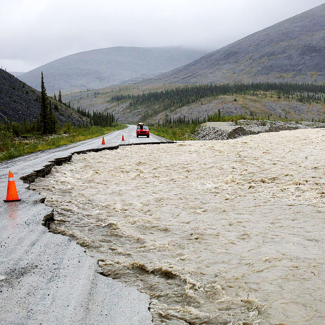
WASHOUT HAVOC – Water has replaced road surface at several parts of the Dempster Highway. Photo by JOE BISHOP
Photo by Photo Submitted
WASHOUT HAVOC – Water has replaced road surface at several parts of the Dempster Highway. Photo by JOE BISHOP
Heavy rains and high waters are responsible for four washouts on the Dempster Highway.
Heavy rains and high waters are responsible for four washouts on the Dempster Highway.
Doris Wurfbaum, a spokesperson with the Department of Highways and Public Works, said early this afternoon there are closures along the highway where the washouts have occurred.
These include km 100 to 105, km 146 (Windy Pass) to 161 (Engineer Creek), km 150 to 255, and km 195 (Ogilvie River) to 237 (airstrip).
All are north of Tombstone Mountain, which is still accessible.
Wurfbaum said crews are working to contain the washouts and repair culverts, but it could take a while.
She said a single lane should be open to travellers by the end of the day, but this is dependent on weather and water receding.
Further updates will be provided at 511yukon.ca.
The highway joins the Dawson City area to Inuvik, N.W.T.
In order to encourage thoughtful and responsible discussion, website comments will not be visible until a moderator approves them. Please add comments judiciously and refrain from maligning any individual or institution. Read about our user comment and privacy policies.
Your name and email address are required before your comment is posted. Otherwise, your comment will not be posted.
Be the first to comment