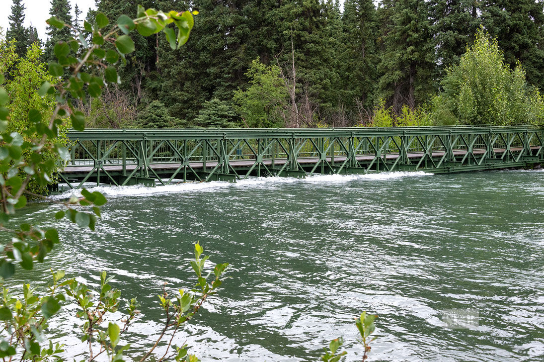
Photo by Vince Fedoroff
WATER LAPPING AT BRIDGE – The bridge to the Bert Law Park, seen Thursday, is closed due to the high water.
Photo by Vince Fedoroff
WATER LAPPING AT BRIDGE – The bridge to the Bert Law Park, seen Thursday, is closed due to the high water.
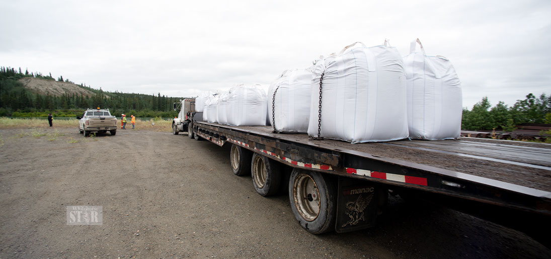
Photo by Vince Fedoroff
PREPARING FOR PROBLEMS – The city prepares to place sandbags in the Marwell area Thursday.
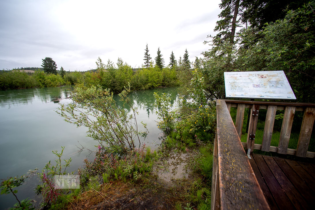
Photo by Vince Fedoroff
HIGH WATER – The Millennium Trail is seen by Earls Restaurant on Thursday.
The City of Whitehorse has spent about $460,000 so far on placing small and large sandbags and on general preparation for flooding, senior officials explained at a briefing Thursday.
The City of Whitehorse has spent about $460,000 so far on placing small and large sandbags and on general preparation for flooding, senior officials explained at a briefing Thursday.
Mayor Dan Curtis emphasized the city is not currently in an emergency situation but is taking steps to prepare out of an abundance of caution.
Officials noted they have established five priority areas:
• The Robert Campbell Bridge;
• The Bert Law Bridge on the Millennium Trail;
• The low-lying areas in the Marwell area;
• Wickstrom Road, which runs along the river between the river and Whitehorse General Hospital;
• The Millennium Trail in general.
Sandbags have already been placed below the Robert Campbell Bridge to Riverdale.
Three of the large super sandbags have been placed at one end of the Bert Law Bridge to help stabilize it, as water is running up against the bottom of the structure. The bridge is located not far from the Robert Service Campground.
Sandbags have also been placed along the Millennium Trail and the other side of the river near the Selkirk pump station.
The city has set up a site at the McLean quarry to fill the bags.
The city received 125,000 small sandbags and 2,500 large superbags last weekend. A few hundred bags have been deployed so far.
Among the flood-related expenses, the city purchased for $33,000 a mechanical device capable of filling 1,600 bags an hour.
It has also established an Emergency Operations Centre (EOC).
There are approximately 30 city staff assigned to help out at the EOC as needed, though they are still performing their regular duties at this time.
Curtis said the response from city staff and the community in general to the call for volunteers has been remarkable.
The mayor said he has seen so many people step up to help out friends and perfect strangers.
From the 10 staff in his office, he knows six who have volunteered, he said.
Curtis said he hasn’t volunteered but has been working steadily with senior staff to monitor and discuss the flood situation.
Mike Gau, the city’s director of development services, is also serving as the planning section chief for the emergency response team.
Gau said the team is meeting daily to review their action plans, which are fluid.
Officials noted the city has a flood information site that is updated daily, and those interested in getting the latest information can access https://whitehorse.ca/flood.
Those interested in hearing a voice message about the most recent information can call 393-8444.
City officials are also encouraging residents to join Whitehorse Alert, the city’s mass notification system.
The city is also in constant contact with the territorial government and Yukon Energy to get the most recent information about water levels and the forecast, officials indicated.
This week’s rainfall was a minor amount, and is not expected to significantly impact the river’s rise, Gau said.
Officials indicated while they can take steps to guard against flooding overland, they can’t do anything about rising ground water levels.
Gau said he’s heard of one or two properties in Marwell have experienced ground water in their basements.
Residents who may experience ground water seepage can call the city to seek advice from the water and waste department, officials noted.
Officials also emphasized residents should stay away from the edge of the Yukon River, as some areas may have become unstable and dangerous.
The Emergency Coordination Centre released the most recent water levels this morning.
The level of Bennett Lake is currently 12.6 centimetres above the level in the 2007 flood year, though it went down by just over a centimetre in the last day.
Tagish Lake is currently eight centimetres above the 2007 level though it has come down a centimetre in the last day.
Marsh Lake is currently 18.3 centimetres above the 2007 level but has come down 1.8 centimetres in the last day.
Lake Laberge is currently 44.2 centimetres above the 2007 level but has come down by almost a centimetre in the last day.
Teslin Lake was 1.83 metres below the peak of 2007.
The level of the Yukon River in the Marwell area was just under half a metre above the peak level in 2007, and has dropped a centimetre in the last day.
In order to encourage thoughtful and responsible discussion, website comments will not be visible until a moderator approves them. Please add comments judiciously and refrain from maligning any individual or institution. Read about our user comment and privacy policies.
Your name and email address are required before your comment is posted. Otherwise, your comment will not be posted.
Comments (7)
Up 8 Down 1
Charles on Jul 21, 2021 at 3:34 am
@Nathan - Do you think it's a good idea if I pay a tax dodger's bills?
Up 10 Down 8
Nathan Living on Jul 19, 2021 at 6:29 pm
As a city taxpayer, I would like the city to put up a couple of thousand sand bags then haul their new sand bagging machine and a few employees out to Lake Laberge and Marsh Lake to help residents and agencies with their sand bagging efforts.
I have seen the Bert Law bridge and there is no present danger there and that bridge would hold even if submersed in the water since the current there is not that fast and a debris load is highly unlikely given its location.
Please share our City resources Mayor Curtis.
Up 21 Down 0
Charlie's Aunt on Jul 19, 2021 at 1:37 pm
@ a a aside: It has been known as Robert Campbell bridge, probably since it was built, but definitely since 1972 when I moved here.
Up 9 Down 47
as an aside on Jul 17, 2021 at 5:42 pm
'Robert Campbell Bridge' ? A highway wasn't enough to 'honour' this Hudson's Bay employee'? Riverdale Bridge is what everyone calls it. Who in the h. thought this one up? "I know! Let's name it after the same guy we named that Robert Campbell highway after! Failing that, let's name it the Lewes or McClintok bridge!"
Up 36 Down 9
Mike on Jul 17, 2021 at 8:44 am
Out of curiosity, where is this equipment capable of filling 1600 sandbags an hour and how is it being put to use for those in the affected areas? If the city has a stockpile of over 100,000 and have only deployed a few hundred I would say load that equipment on a trailer and take it to Lake Laberge or McClintok Bay to fill sandbags! We paid for it.
Up 32 Down 29
Matthew on Jul 16, 2021 at 9:22 pm
Where are the liberals? I'm sure even filling up 1 sand bag and getting a picture doing so would make for a GREAT PR stunt for their obedient followers. haha
Up 22 Down 17
bonanzajoe on Jul 16, 2021 at 5:10 pm
Climate change - nature just doing its little ole thing. Don't try to improve on nature.