Photo by Vince Fedoroff
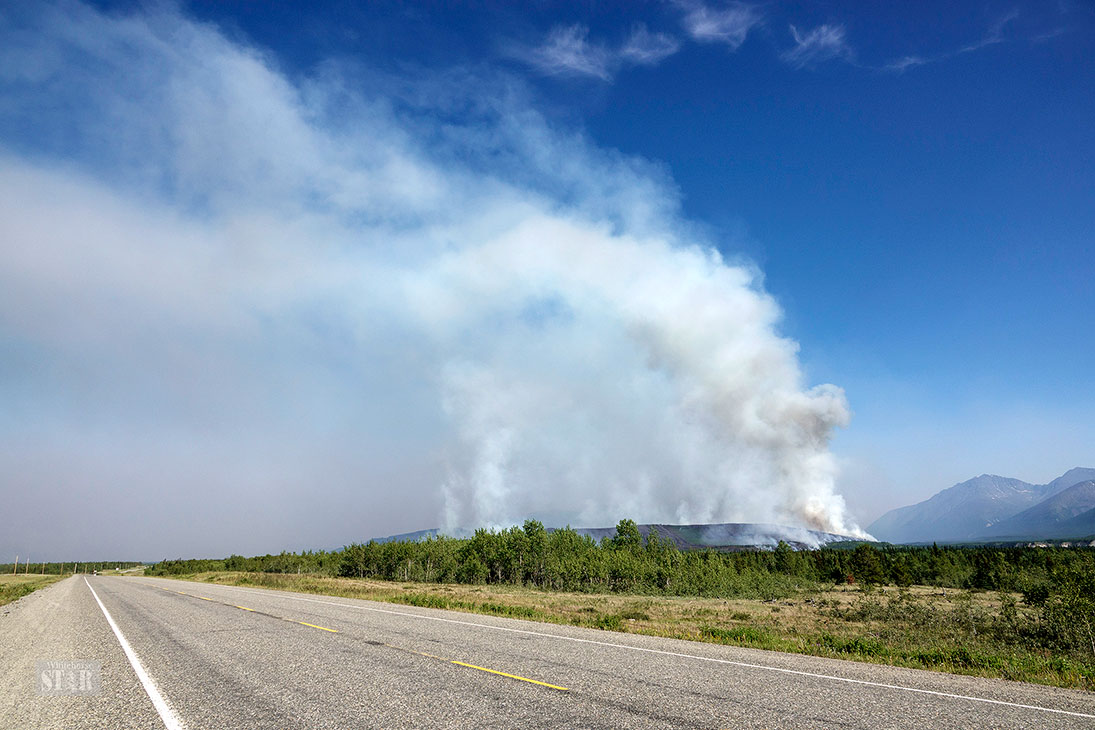
BLAZE SPURS EVACUATION ALERT – The Takhini River Bridge fire west of Whitehorse is seen from the Alaska Highway on Sunday evening.
Photo by Vince Fedoroff
BLAZE SPURS EVACUATION ALERT – The Takhini River Bridge fire west of Whitehorse is seen from the Alaska Highway on Sunday evening.
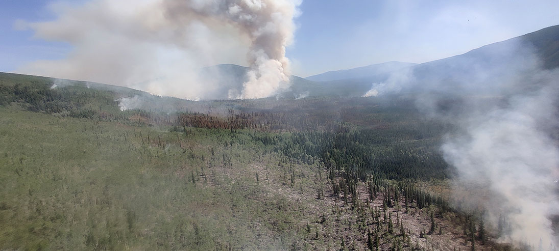
Photo by Photo Submitted
CENTRAL YUKON FIRE BURNING UNEVENLY – The Reverse Creek faire, 10 kilometres northwest of the Silver Trail in central Yukon at its closest point, is seen Sunday evening. The blaze is burning unevenly since the landscape is not continuous forest. Winds from the east have pushed the fire to the north, and it is now 1,083 hectares in size. An evacuation alert remains in place for properties between Kilometre 10 and Kilometre 35 of the Silver Trail. Photo courtesy YUKON GOVERNMENT
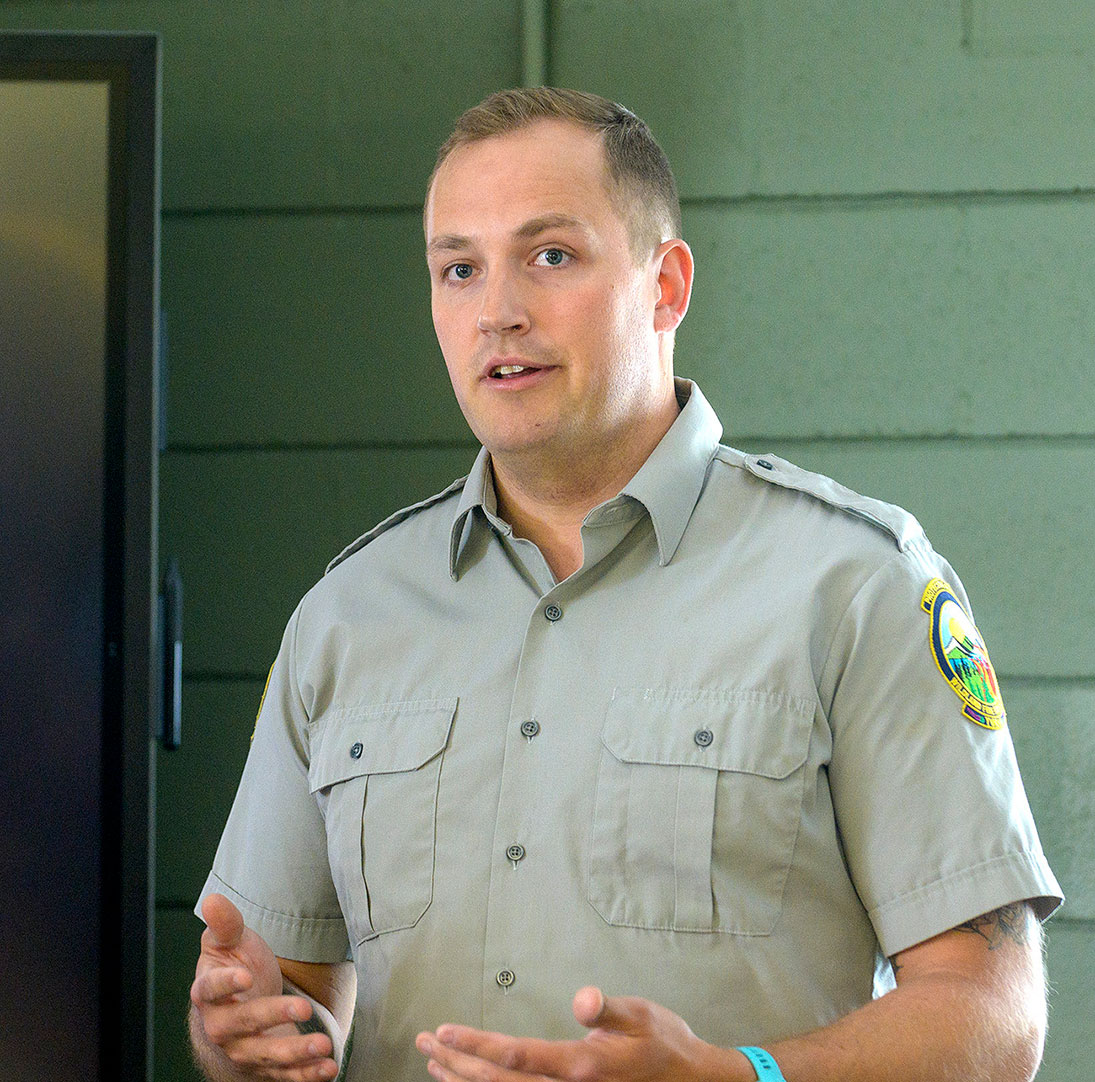
Photo by Whitehorse Star
Government of Yukon fire information officer Mike Fancie
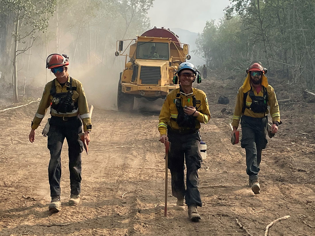
Photo by Photo Submitted
WEARYING TOIL – A Yukon Wildland Fire Management crew walks along a smoky, dusty road near the Takhini Bridge fireline. Smiling crew members carry pulaskis, a firefighting tool combining the functions of an axe and a hoe.
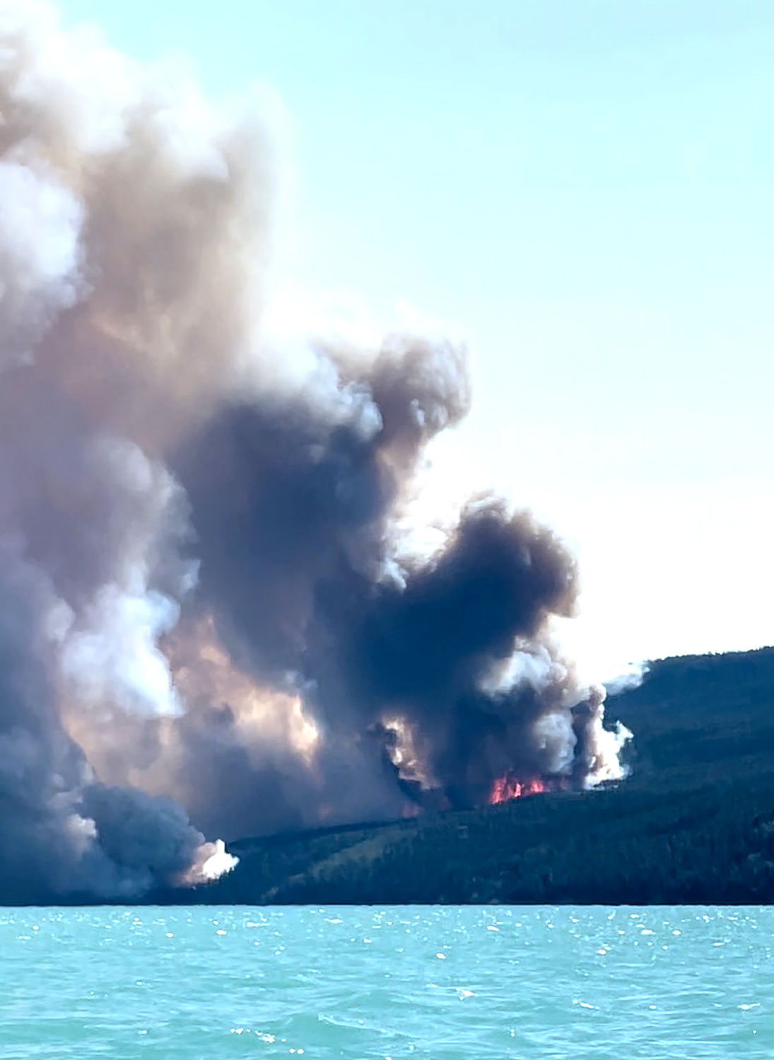
Photo by Photo Submitted
SMOKY BUSINESS – A wildfire is seen burning late last Saturday afternoon in the Taku Arm area of southern Yukon. Photo by JESSICA PIERCE
Despite significant growth in both the Takhini Bridge fire west of Whitehorse and the Reverse Creek fire between Stewart Crossing and Mayo, both are currently burning away from highways and homes, according to information from the Yukon government.
Revised - Despite significant growth over the past two days, both the Takhini Bridge fire and the Reverse Creek fire continue to burn away from homes and highways.
As of this morning, Yukon Wildland Fire Management has not changed any evacuation orders put in place last weekend.
Widespread smoke continues to impact the Yukon, with some of it coming from large fires in northern B.C. and other localized smoke coming from fires in the Yukon.
“While we know seeing plumes of smoke nearby can be stressful, we’re urging all Yukoners to keep themselves informed and stay calm,” Community Services Minister Richard Mostyn said during a Tuesday afternoon press conference.
“The intense wildfire season our neighbours to the south have experienced this summer has finally arrived in the territory,” Mostyn said.
There are now 17 active fires in the Yukon, though only the Takhini Bridge fire west of Whitehorse is being fought by Yukon Wildland Fire Management. The rest are not currently threatening structures and are being monitored.
Talking with the Star Tuesday morning, fire information officer Mike Fancie said residents concerned about impacts from smoke should visit their health care provider, while explaining that smoke can travel hundreds of kilometres and doesn’t mean immediate danger.
Much of the smoke in the Whitehorse area is from the Takhini Bridge fire, Fancie said, though some is blowing in from B.C. as well.
He also reported that the Yukon firefighters deployed to Alberta and Quebec have now returned.
The Yukon has about 72 firefighters in total, and it’s common for provinces and territories to share resources with each other and with some western states in the U.S.
A few people who work for Wildland Fire Management are still in provinces, but Fancie said they don’t include actual firefighters and won’t have an impact on the Yukon’s readiness.
The government has now instituted a territory-wide level 2 fire ban.
This restricts warming and cooking fires to established fire pits in road-accessible campgrounds and prohibits the lighting of all other fires.
They had been trying to provide flexibility in the fire bans, and Fancie said at the press conference the low number of person-caused fires in the territory this season led them to be more relaxed with restrictions so far this season.
After the Takhini Bridge fire began last Saturday evening, the level 2 fire restrictions were put in place, as any new fire needing attention would put an added strain on the Yukon’s firefighting resources.
Takhini Bridge Fire
The wildfire near the Takhini River Bridge at kilometre 1468 of the Alaska Highway continues to grow.
Cooler temperatures and cloudy conditions have aided firefighters in controlling the fires spread away from the direction of homes, according to a bulletin from Yukon Protective Services mid-day today.
Firefighters continue to build fire guards on the north side of the fire to protect structures and keep it moving away from the Alaska Highway.
This morning, Wildland Fire listed its size at 1,398 hectares, compared with 782 the day before and 270 last Sunday.
Most of this growth is to the south, and east up and over Ibex ridge.
This means it’s still travelling away from structures.
There are currently 28 personnel fighting the fire along with aircraft and heavy equipment.
This includes a 14-person First Nation Wildfire crew hired by Wildland Fire and the Yukon’s only heavy-duty AS-332 Puma helicopter, capable of carrying 3,800 litres of water.
Separately, the Yukon Fire Marshal has structure protection units on site should the fire turn toward homes.
Fancie said Tuesday they have moved beyond the initial attack phase of trying to actually put the fire out, and the goal has now changed to try to manage the fire to keep it from impacting homes, roadways and other structures.
Most of the current work is making fire guards with bulldozers and lighting small fires to burn off areas before the main fire reaches them.
Fancie said Wildland Fire is now also considering using aerial ignitions from helicopters to burn off larger areas and expand the size of the guards.
This is a tricky process, he said, requiring highly trained personnel and favourable wind conditions.
The wind will continue to have an impact on how this fire behaves and the ability for Wildland Fire to get in and work.
The Yukon Fire Marshal’s office is still investigating the cause of the fire, and would not yet release its findings.
“The cause of the fire is still under investigation and the fire marshal’s office was on scene Sunday,” Fancie said Tuesday morning.
“We aren’t able to describe the fire marshal’s findings until they’re able to complete their work.”
The evacuation alerts for 155 homes between the Takhini River Bridge and Echo Valley Road remain unchanged.
The Alaska Highway is still open, and Wildland Fire is asking anyone travelling through the area to avoid stopping so fire crews can ensure safe access on those roads.
Fire officials have met with the Champagne and Aishihik First Nations and the Ibex Valley Local Advisory Council to provide more information.
They released a fresh update early this afternoon, saying the situation is stable in the Ibex Valley as crews expand defences.
“Today, cloudy conditions are expected to bring slightly lower temperatures and a chance of scattered showers,” officials said.
“While this will have a limited impact extinguishing the fire, it will reduce fire behaviour and responders will be able to focus on expanding defences around the fire’s edge.
The fire is still considered out of control, according to this update.
Wildland Fire described the strategy to come.
“A second guard has been developed along the eastern flank of the fire where crews will remove fuel between the new, eastern guard and the fire.
“Other crews will continue to remove forest fuels to a 25-foot depth from the guard on the fire’s northern edge, which has continued to hold.”
Plans are in the works to build another fire guard at the base of the Ibex Ridge by clearing the area with a bulldozer to help contain the fire’s
southeastern zone.
Reverse Creek Fire
The fire near the Silver Trail has grown significantly as well, but also away from homes and into a patchy area of forest that has made it easier to manage, Fancie said Tuesday.
As of this morning, it’s getting what Wildland Fire calls a “monitored response,” meaning they are simply letting it burn while keeping a close eye on it.
The fire has stayed about 10 kilometres from the Silver Trail highway at its closest point, according to a Facebook post from Yukon Protective Services on Tuesday.
“That’s pretty good news for the people on evacuation alert along the highway there,” Fancie said.
The alert covers kilometre 10 to 35 on the Silver Trail, and will stay in effect for the time being out of an abundance of caution, according to Fancie.
In these situations, he said, they want people to be aware of the danger and ready to go, but he emphasized there is currently no real threat to people’s safety.
“If the situation was dire and unsafe, people would have been evacuated already,” he said Tuesday.
The fire was listed at 3,690 hectares as of this morning. On Tuesday, Yukon Protective Services listed the fire at 1,083 hectares, while last Sunday they had reported it at 320 hectares.
Wildland Fire does not currently have personnel battling this blaze, but is monitoring the situation. Fancie said there is a fire lookout tower very close by, allowing for a constant watch.
Other Regional Fires
Three other major fires are impacting the region, mostly with smoke.
The Illusion Creek fire, 16 kilometres south of Little Salmon Lake, is burning in a wilderness area and is listed currently at 8,700 hectares.
Fancie says this fire has not seen much perimeter growth, but there is still activity occurring in unburned areas within the fire boundary.
Smoke from this fire is currently impacting Faro, Fancie said Tuesday.
There is also a fire to the south in B.C. near Tagish Lake that’s sending a good deal of smoke into the region. B.C. Wildfire Service is currently listing that fire at 1,800 hectares.
Another fire in the Little Blue River area in B.C. south of Watson Lake is also causing smoky conditions north of the border. This fire is listed at 30,000 hectares by B.C. Wildfire.
Many fires continue to burn across northern B.C. in what has turned into a record-setting fire season. Fancie said he has been in contact with the B.C. Wildfire Service to keep updated on the situation to the south.
There have been recent brief highway closures associated with some regional fires, including on the Dempster Highway in the Northwest Territories and the Stewart-Cassier Highway in B.C. Fancie said at Tuesday’s news conference those highways had fully re-opened.
Travellers can visit https://511yukon and https://www.drivebc.ca for current road conditions.
Wildland Fire operates an online information hub with bulletins, interactive maps and smoke activity maps at https://wildfires.service.yukon.ca
In order to encourage thoughtful and responsible discussion, website comments will not be visible until a moderator approves them. Please add comments judiciously and refrain from maligning any individual or institution. Read about our user comment and privacy policies.
Your name and email address are required before your comment is posted. Otherwise, your comment will not be posted.
Be the first to comment