Thinking back to 63 years ago
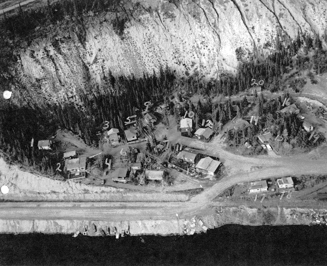
With the escarpment being in the news in recent weeks, I was reminded of the accompanying aerial photo, taken circa 1960.
By Whitehorse Star on June 16, 2023
With the escarpment being in the news in recent weeks, I was reminded of the accompanying aerial photo, taken circa 1960.
I used it in my book, Squatters of Downtown Whitehorse (p. 34).
Notice the old cars holding the bank in the foreground to protect the narrow road going to the rapids.
Oldtimers used to joke about the fill used – said to be Buzzsaw Jimmy’s saw, lots of U.S. Army scrap metal, cookstoves, etc.
Robert Service in 1904 loved to walk along the tracks to Miles Canyon on his day off from the Bank of Commerce, composing his poems.
He also loved to hike up Puckett’s Gulch to the top of a treed area (now the Whitehorse airport).
The photo shows all the squatters (c. 1960) near present-day Drury Street.
The property was eventually purchased by squatters.
There is still one squatter house (#1) in its original location.
Should it be preserved?
Pat Ellis
(Whiskey Flats, 1954)
Whitehorse
Be the first to comment